Thompson Bay, Long Island
After a few weeks in Georgetown we decide to make a side trip and explore Thompson Bay on Long Island, not to be confused with New York's Long Island. N57 Worknot and N68 Floating Stones also are making the 3-4 hour trip. Long Island is further south and east of Georgetown; more remote with fewer boats in the anchorage.
 |
| Even the storm clouds are spectacular in the Bahamas! |
Land Ho!
Bahamas plays a big role in the arrival of Europeans in the Americas. Christopher Columbus made his first landfall on the easternmost Bahamas’ island of San Salvador October 12, 1492. A few days later he reached Long Island’s Cape Santa Maria. A monument on the northern tip of Long Island commemorates Columbus’ landing.
Teaming up with Bryan and Cheryl from N68 Floating Stones, we rent a car to visit this memorial and tour Long Island. The memorial's setting is spectacular with white cliffs, turquoise inlets, deep blue seas, and breaking waves. Not a very hospitable coastline for a landfall. Makes you wonder how Columbus did it?
We spend the day slowly driving from the very northern end of Long Island, to Clarence Town in the south end. The island is very rural with an abundance of small churches.
 |
| Churches... |
 |
| ...Churches |
 |
| ...And more churches! There were a really high number of churches on Long Island. |
We check out “the bridge to nowhere”, inlets and empty beaches, an abandoned boat, and venture down a long dirt road to meet Gale and Mary (Worknot) and Sam and Cindy (Booke-End) for lunch at a very remote little restaurant, Chez Pierre.
 |
| A wonderful heavy duty bridge that goes to absolutely nothing on the other side. |
 |
| Worknot to the left, and Bravo off in the distance. |
 |
| I don't think this boat is going anyplace soon. |
 |
| The long and dusty road to Chez Pierre. |
The road trip also takes us to Dean’s Blue Hole, site of the world free-diving competitions. We take a peek. It’s cold, windy and 663 feet deep. We pass on the chance to “take a dip”!
 |
| The world famous "Blue Hole". |
 |
| This is the "Blue Hole", and it's surprising that it's that deep right next to the shore. |
Back on the boat, dark skies signal some nasty weather passing through the bay. The strange light makes it look like Floating Stones is on a silver sea.
 |
| Floating Stones, and yup, it's goin' to rain! |
After spending a few more days at Long Island, the weather clears, we pull anchor with Floating Stones and head back to George Town. Blue skies, turquoise water, and a following sea make for a quick and relaxing trip back to our Elizabeth Harbor anchorage.
 |
| Another gorgeous day, with Nora at the helm. |
 |
| The channel to George Town has you going fairly close to these small islands/hazards. |
Layover - Elizabeth Harbor, George Town
Back in Elizabeth Harbor, the weather turns nasty with high winds and rough seas for 5 days in a row. No one gets off their boat for at least 3 days. At night the “floating city” is illuminated by 300+ dancing anchor lights. It really is a sight to see.
Meander North
The weather finally clears, we decide to make an early morning start for our slow migration north.
Apparently, many other cruisers have the same idea. As we make our way out of Elizabeth Harbor, there are at least 30+ other boats heading in the same direction. Rush hour in the Bahamas!
 |
| For awhile it felt like we were in the middle of a sailboat regatta! |
Along the way, we are treated to a beautiful rainbow off our bow.
 |
| Somewhere over the rainbow... |
The first part of the run north is off the eastern coast of Great Exuma Island. This is deep open water of the Atlantic Ocean. The eastern coast line is steep rocky and devoid of any safe anchorages. We have to go through Galliot Cut to get back to the shallow protected Grand Bahamas Banks. We tried to time the transit at slack tide, but we weren’t exactly on schedule. Breaking chaotic waves greeted us as we went through the cut, but we made it safely to the other side!
 |
| It's actually a very narrow cut that we go through. |
 |
| The waves and current through the cut is a little worse than how it appears. |
Black Point
Our destination is Little Bay, Great Guyana Cay. It is a large open anchorage around the corner from Black Point Settlement. When we arrive, along with Worknot, there are only two other boats in the bay.
Little Bay has no amenities. However, a fast 7 minute dinghy ride brings you to the very small town of Black Point. Handmade signs direct you to the local businesses and attractions.
 |
| As you can see, most things are within a 1/2 mile. |
We are anchored off a beach that is the site of a “broken Bahamas dream”…. A deserted resort development. There are remnants of a beachside tiki bar, and a sign laying on the beach advertises available real estate.
 |
| Sadly, there was no bar service today. |
 |
| Have we got a deal for you! |
Our hike to the top of the hill gives us a view of the abandoned marina dredging project.
 |
| This abandoned project to dredge a marina was huge and costly. |
We continue our short walk across the island to the eastern side and are greeted by steep bare rocky cliffs and crashing waves. The waters of the North Atlantic Ocean traveling from the coast of North Africa finally hit land. It’s a stark contrast with the calm shallow sandy beach on the opposite side of the island.
 |
| An amazing difference just a short distance between one side of the island to the other. |
 |
| The rocks here are like a topographical map. |
 |
| Gale, Mary, and Keela wondering if this is lovers leap? |
Cruising in the Time of Coronavirus
We understand and are aware that this is an unprecedentedly difficult time for people around the world. In February and early March, the Bahamas is still somewhat isolated from the corona chaos quickly overwhelming the US and Europe. We closely monitor the situation via the internet and cruisers networks on the VHF radio and contemplate how to adapt to new information. By continuing the blog of our travels, we are not trying to ignore, or make light of this situation. To keep in touch with family and friends, we continue to post new chapters of our blog including how coronavirus is impacting cruisers… people who live on boats.
Guidelines and Restrictions
In late March, the corona virus reaches the Bahamas with a few cases in Nassau. Cruise ships and commercial charter boats are banned. A night-time curfew is imposed, group sizes are limited to 10 people, and restaurants are restricted to carry-out only. The mail/supply boats, lifeline of the islands, maintain their regular schedule, so the small grocery stores continue to stock the basics, including toilet paper! As in the states, rules and restrictions change daily.
 |
| This is one of 2 grocery stores in the area. Both are attached to a residence. |
 |
| But low and behold they have all of the essentials! |
What awaits us when we return to the US is uncertain. Some Florida marinas are temporarily closed to transient boats but are open only for fueling.
Safe Space
“Social distancing” is a standard function of cruisers who typically travel with only 2 people (a couple) on board and primarily anchor out, remaining isolated for several days at a time. Safe anchoring distance between boats is always at least 100-300 feet between boats. Plenty of social distance there.
 |
| You have to practice "Social Distancing" when anchoring. |
When visiting other boats, cruisers remain in their dinghy when conversing with people on the back deck similar to neighbors talking from the sidewalk to a front porch.
The Bahamas beaches, before and after the coronavirus issue, are EMPTY! Definitely no spring break beach party here!
 |
| Every beach seems beautiful and unique. |
 |
| Nora loves to go for beach walks. But who wouldn't on beaches like this? |
 |
| The water is just totally amazing! Clear as gin! |
Heading North… one anchorage at a time
As March moves on, we have one month remaining on our cruising permit. The Bahamas government is allowing cruisers to travel within the islands, so we continue to work our way north choosing more remote islands and less populated anchorages. The Bahamian people we meet continue to be warm, welcoming, friendly and helpful. We are fortunate to be their guests.
Staniel Cay
We stop at Staniel Cay for re-provisioning, and one more visit to the swimming pigs.
Its island and town are as beautiful as we remember. Some strange new floating creatures join us in the anchorage.
 |
| Made us smile! |
We meet local fishermen and buy two huge Bahamas lobsters fresh off their boat. Using Clark and Michele’s (N55 Roam) recipe for “Bahamas Bites” we feast on panko-coated fresh lobster with garlic aioli! Yummy!
 |
| What a treat! We finally were able to purchase live lobsters. |
 |
| This was the first time we prepared the lobster this way, and it was superb! |
Cambridge Cay
Next stop north is Cambridge Cay in the beautiful Exumas Land and Sea Park. Following the narrow channel into the harbor, we pass an amazing high tech superyacht aptly named “BOLD”. It looks like a boat that a retired Navy SEAL or aircraft carrier captain would own if they won the Powerball Lottery! The crane on the foredeck looks like it could launch a submarine, and that aft deck looks like a helicopter landing pad.
 |
| "Bad Ass" comes to mind here. |
We tie up to the park’s mooring balls. Anchoring is prohibited in this part of the park. Dropping the dinghy, we head to a remote sand bar, for a stroll.
We are the only humans in sight, but previous visitors built precarious rock memorials of their presence.
 |
| A man's best friend (Keela), is faithfully following Gale. |
 |
| Stone monuments left by previous alien visitors? |
Other fragile relics of sea life dot the beach.
 |
| A dead crab bleached from the sun. |
 |
| You see the remains of a lot of conch shells on the beaches. |
 |
| More conch shells, and we've seen some areas that are totally covered with conch shells. |
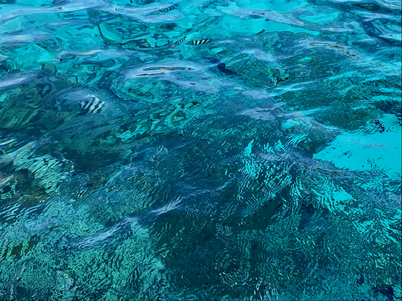
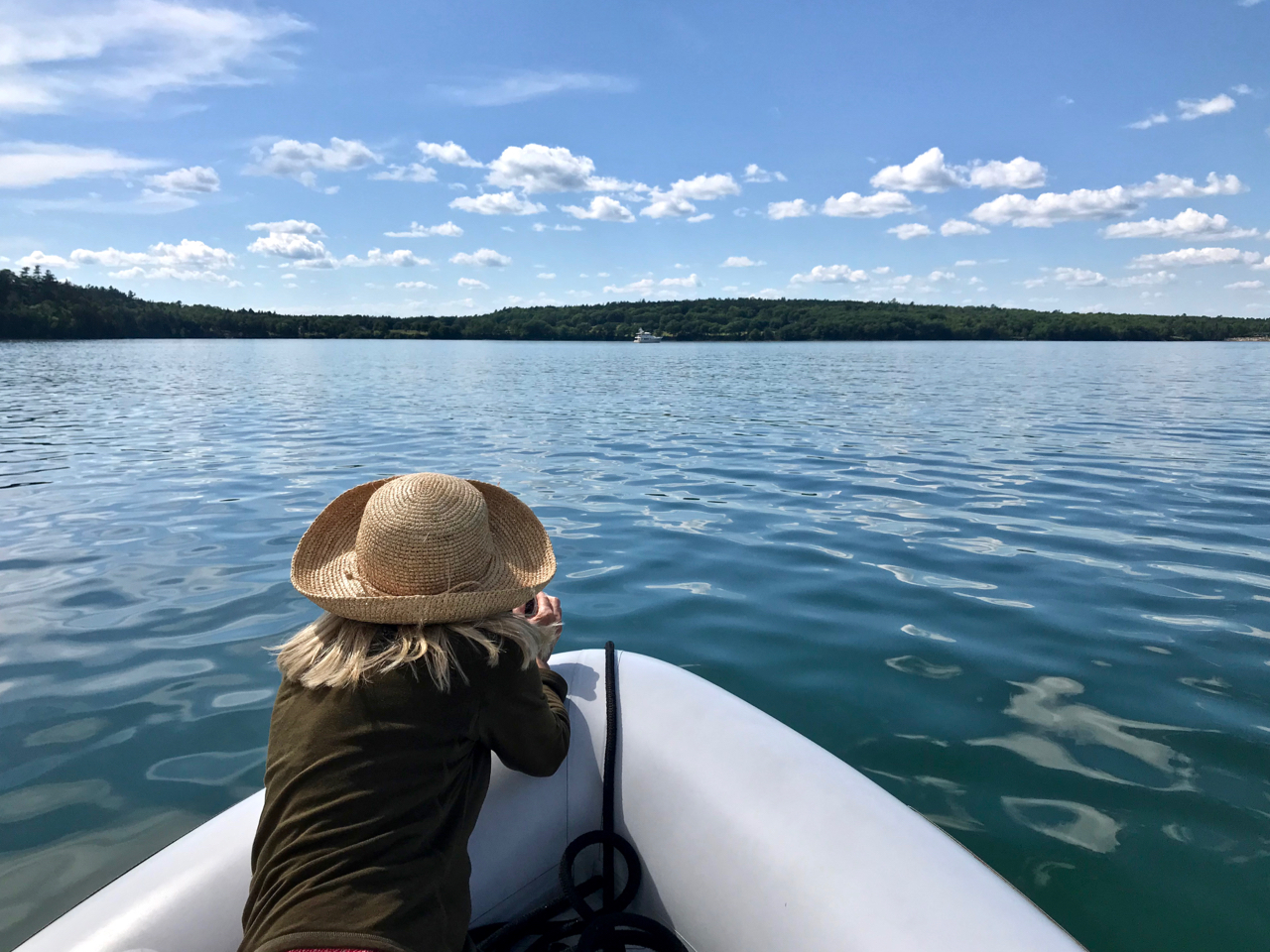
We head to another remote area to a snorkel spot known as “the aquarium” and are also visited by a sea turtle. Then we relocate to another dive destination with a sunken airplane, and use our glass bottom buckets to get a better view!
 |
| Gale appears to be levitating. |
 |
| At times, the ripples on the water's surface looks like an abstract painting. |
 |
| This sea turtle just casually looked at us and swam on by. |
 |
| When we didn't snorkel, the glass bottom bucket worked well. |
 |
| This was pretty cool seeing this wrecked plane in about 10' of water. |
 |
| Viewing fish from our glass bottom bucket. |
While we are thoroughly enjoying the amazing Exumas Land and Sea Park, the corona virus situation in the Bahamas continues to deteriorate. The prime minister is shutting down the parks and tightening travel restrictions. We realize our days in the Bahamas are coming to an end. Once again we discuss cruising options with our buddy boat, Worknot, and decide to speed up the departure schedule.


Comments
Post a Comment